
Honda Built Navigation Before GPS Using Helium, Transparent Maps and a Glowing Green Dot
by AutoExpert | 14 September, 2026
There was a time when getting lost required some commitment. A driver would unfold a road map across the steering wheel, locate two towns that appeared to be printed directly on top of one another, then attempt to memorize six turns before pulling back into traffic. The map would refuse to fold along its original creases afterward. Arguments with passengers came as standard equipment.
Honda thought the car should be able to help. That was an ambitious idea in the 1970s, when GPS was unavailable to civilian drivers and a useful digital map of an entire city could not simply be downloaded onto a dashboard computer.
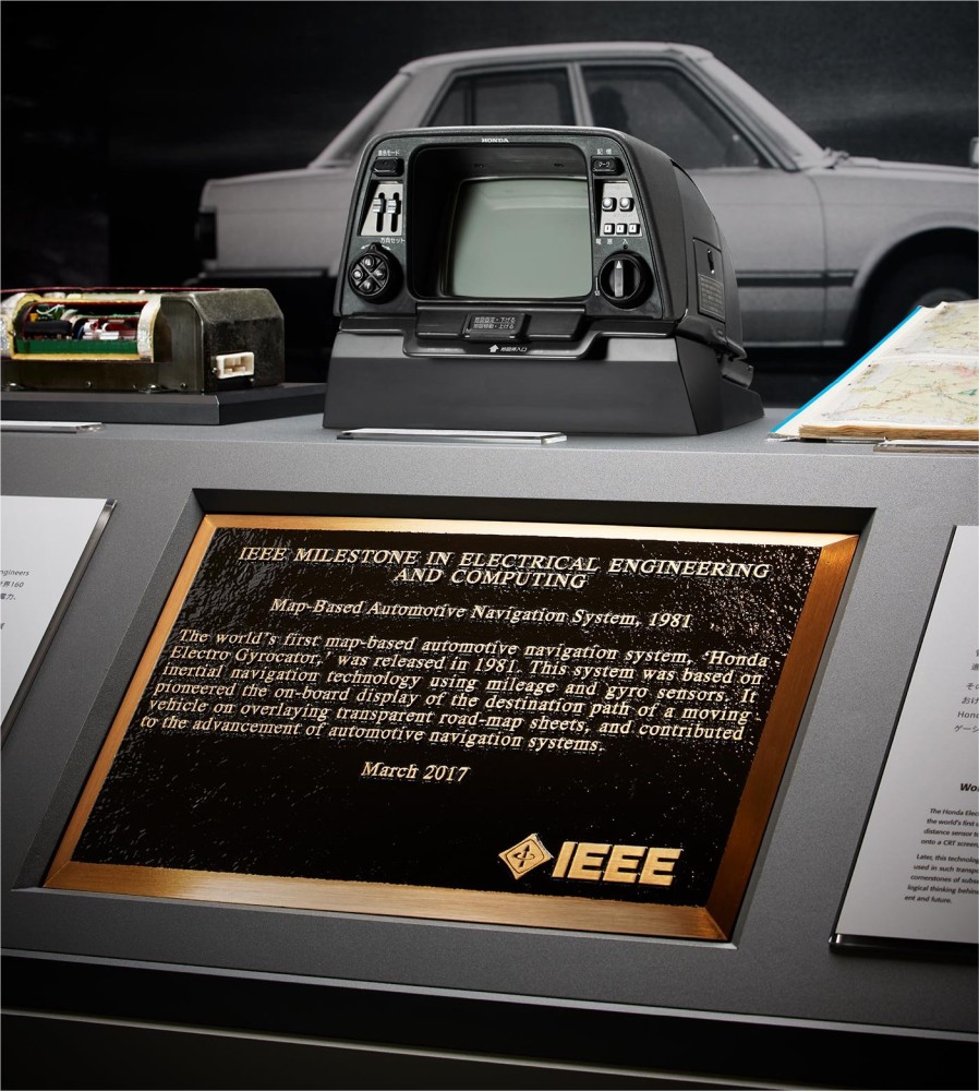
The result arrived in Japan in 1981. Called the Electro Gyrocator, it is recognized by Honda and the IEEE as the first map-based automotive navigation system. It could track the movement of a car, display its progress and help its occupants determine where they were going.
It accomplished all of this without communicating with a single satellite.
The idea reportedly began with a tank
According to Honda’s history of the project, the company began considering automotive route guidance as part of a larger electronics program during the 1970s. The engineers understood the basic problem immediately. Before a car could guide its driver anywhere, it first had to know where it was.
One important inspiration came when Honda executive Tadashi Kume watched a Japanese Self-Defense Forces tank moving over uneven ground. Although the vehicle was pitching and bouncing, its gun could remain pointed in the intended direction. A gyroscope helped make that possible.
Aircraft and ships already used inertial navigation, but their equipment was too large, complex and expensive for an ordinary automobile. One conventional gyroscope examined by Honda reportedly contained more than 200 parts. That was hardly ideal for something expected to survive potholes, summer heat and years of unsympathetic ownership.
The breakthrough was a much simpler gas-rate gyroscope containing just eight principal parts. Inside it, a stream of helium gas moved past two heated wires. During straight-line travel, the gas affected both wires equally. As the car turned, the flow shifted, producing a temperature difference that electronics could interpret as a change in direction.
A sensor connected to the transmission measured the distance travelled. Combining distance with directional changes allowed the system to calculate the car’s movement from a known starting point.
This technique is called dead reckoning. It does not provide an absolute position in the way satellite navigation does. Instead, it begins with a location entered by the user and continuously estimates where the vehicle has moved since then.
Sailors had used the underlying principle for centuries. Honda gave it a 16-bit computer and installed it in an Accord.
The maps were beautifully, awkwardly physical
The Electro Gyrocator did not contain a digital street database. Storing that much map information inside a reasonably sized automotive computer was not practical in 1981.
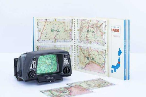
Honda’s solution was far more tactile. Transparent map sheets were placed over a six-inch cathode-ray-tube display mounted in the dashboard. A glowing mark showed the car’s calculated position while the travelled route appeared on the green screen beneath the map.
The effect must have looked impressively futuristic, at least until the route reached the edge of the sheet. The driver or passenger then had to remove the old map, insert another and align it with the car’s displayed trajectory.
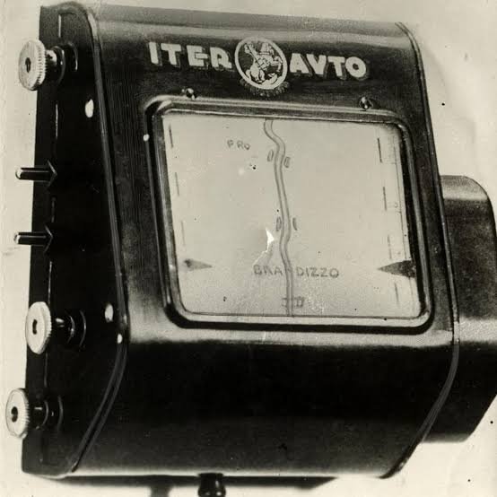
Even producing the transparent maps presented a problem. Ordinary road maps are designed to be readable, which means cartographers sometimes alter spacing or simplify crowded areas. Two roads that sit very close together in reality may be separated slightly on paper so that both remain visible.
That harmless adjustment becomes troublesome when a computer is trying to place a moving dot precisely on one of those roads. Honda therefore worked with a mapmaker to produce dedicated sheets accurate enough for the system.
The machine still required help from its occupants. The gyroscope needed time to warm up, and the initial position had to be matched with the map. Small measurement errors accumulated during a journey, allowing the displayed position to drift away from the actual road. Controls let the user rotate, reposition and correct the display.
It offered no spoken instructions. It did not know that a road had closed, and it certainly could not warn that a faster route had just become available. Yet the central experience was strikingly familiar: the vehicle’s position moved across a map while the car travelled.
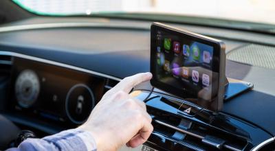
The smartphone mounted beside a modern steering wheel is performing the same basic piece of theatre with far more information behind it.
Brilliant engineering met a difficult sales pitch
The Electro Gyrocator was offered as a dealer-installed option for the second-generation Honda Accord and Vigor in Japan. IEEE’s account puts its contemporary price at the equivalent of $2,746, nearly one-quarter of the car’s price.
That was a serious amount of money for a system that required special maps, manual alignment and occasional corrections. It also occupied considerably more space than the slim screens now fitted to economy cars.
Unsurprisingly, it did not become a mass-market success. The number of customer installations is unclear, and Honda soon began pursuing more automated systems with digitally stored maps and automatic map matching.
Those later developments created their own difficulties. Digital maps demanded storage capacity that early automotive computers did not possess. Honda experimented with large floppy disks and optical media, while the industry searched for a practical way to package detailed road information inside a car.
In 1985, the Etak Navigator brought digital map storage and sophisticated map matching to the American market. Honda introduced a digital-map navigation system in the Legend in 1990. GPS-based systems followed as satellite access, computing power and mapping data improved.
The Electro Gyrocator was quickly left behind, but that does not make it a technological dead end. Its engineers had already identified many of the problems every navigation developer would face: measuring movement, displaying position, correcting drift, matching a vehicle with a road and presenting all of it without overwhelming the driver.
In 2017, the IEEE recognized the system as a Milestone in electrical and computer engineering. That honor was not awarded because the Electro Gyrocator sold in huge numbers. It was awarded because Honda had demonstrated what automotive navigation could become.
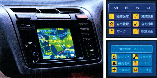
Today, navigation calculates live traffic, suggests charging stops, searches for restaurants and quietly reroutes a journey after the driver ignores an instruction. Its map can cover an entire continent without anyone opening the glove compartment.
The first car navigation system demanded more patience. It needed helium, a warm-up period, a stack of transparent maps and somebody willing to keep its glowing dot in the right place.
It was inconvenient, expensive and astonishingly early.